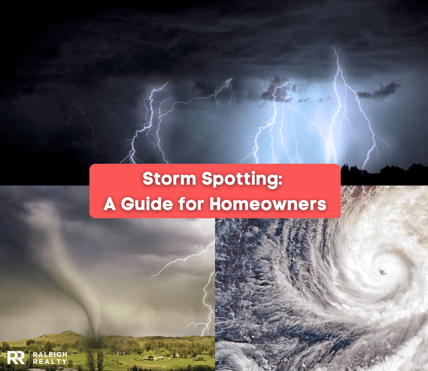
Storm Spotting: A Guide for Homeowners
December 23rd, 2021
Chapters
What is Storm Spotting?
An estimated total of 16 million thunderstorms occur each year. While most storms are harmless, there are certain severe storm types that are known to inflict damage to buildings and can endanger the lives of individuals. With the help of storm spotting, the details of potential weather hazards can be reported to the public ahead of time in order to limit the number of damages, injuries, and fatalities in the event of severe weather.

Defined as the observation of severe weather and the monitoring of storm development and progression, the act of storm spotting plays an important role in public safety. By identifying the physical structure of severe storms and learning how to identify different types of storms, storm spotting has led to better warning systems and informational statements put out by the National Weather Service and local news stations.
While weather watching has been a popular activity for over a century, trained storm spotters today analyze temperatures, barometric pressure, wind speed, and doppler radar to make weather observations. Playing a vital role in everyday life, storm spotting benefits the general public and local public safety officials.
What is a Storm Spotter and Who Can Be One?
Storm spotters are generally trained individuals who want to learn more about the weather while providing a service to the local community. Since storm spotters are volunteers and not meteorologists, becoming one is relatively easy and is open to anyone who is interested. After attending a free Skywarn training class provided by the National Weather Service, storm spotters will learn about different thunderstorm types and how to file a first-hand report when encountering severe weather.
Storm Spotter Vs. Storm Chaser
Defined as the deliberate pursuit of severe weather, storm chasing is dangerous and is best left to the professionals. Compared to storm spotting, chasers will often travel thousands of miles a year to get up close and personal to severe weather, while storm spotters typically remain close to home. Allowing researchers to observe storms up close to gather data, storm chasers are generally made up of scientists who study weather and want to learn more about severe weather phenomena.
Considerations for Homeowners
Even if weather patterns may not be the number one deciding factor when moving to a new area, staying up to date with the local weather of a region will lead to better home-buying decisions. Knowing about what severe weather events and weather risks are frequent in the area that are you looking to buy will ensure your safety as a new homeowner.
If you are looking at homes for sale in Raleigh for example, it is important to educate yourself about the severe weather conditions that the city experiences. Known for its seasonal variation and high risk of thunderstorms, flooding, and potential hurricanes, make sure to prepare for any possible severe weather when buying a house in Raleigh.
Whether you are on the hunt for Raleigh townhomes for sale or single-family homes, it might be a good idea to figure out the cost of homeowners insurance and determine whether or not the area you are looking to buy is at a high risk of natural disasters before moving to Raleigh. If you are looking to sell your home in Raleigh, the same conditions should be thought through before moving to a new area.
How to Become a Storm Spotter
Once you have decided that you want to become a storm spotter then it is time to attend a storm spotter training class that is offered in your area. This volunteer training program is called Skywarn and is taught by the National Weather Service. Offering both online storm spotting courses and local storm spotting courses, these training sessions feature interactive presentations from meteorologists.
Typically held in early spring during the months of March or April, these training classes normally last around two hours long and are free of charge. Recommended for ages 18 and older and open to the general public, training is held in the evenings during the week and on select Saturdays. Since the location for local training classes may vary, spotters may need to travel up to 15 miles to attend a nearby local session.
Are you interested in learning more? Find a program and training schedule in your area.
What Weather Events Do Spotters Look For?
Trained storm spotters are taught how to identify severe weather and how to distinguish the different physical structures of severe storms. The most common weather events that storm spotters look for and report include:
-
Tornadoes
-
Flash Flooding
-
Wall Clouds
-
Funnel Clouds
-
Lightning
-
Winter Weather
-
Wind
-
Hail
-
Marine Hazards
-
Additional Environmental Hazards
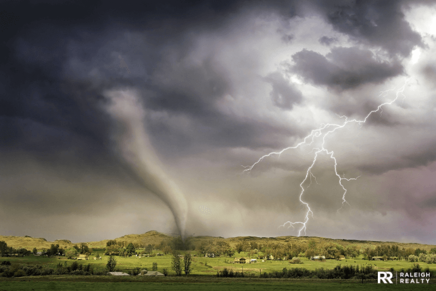
Tornadoes
Tornadoes develop from severe thunderstorms when warm air meets a cold front. Recognized as a violently rotating column of air that is capable of inflicting mass destruction on any area that it touches, tornadoes can last for more than twenty minutes and can have winds that reach speeds of 200 to 300 miles per hour. The common signs of tornadoes include a dark or green-colored sky, low-lying clouds, large hail, and a loud roaring noise that sounds like a freight train.
Safety Information
Since tornadoes can impact anywhere in the country at any time during the year, there are certain tips and safety precautions to take that will help keep you and your family safe if a tornado strikes.
-
Identify a safe place in the home to gather such as a basement, storm cellar, or interior room with no windows on the lowest floor.
-
Protect your head and take shelter under something sturdy for additional protection.
-
Do not stay in a mobile home.
-
Prepare an emergency kit ahead of time including water, non-perishable food, and medication.
-
Watch out for weather conditions.
When and What to Report
If you spot a tornado, immediately seek shelter and help alert others in the area by reporting it to the National Weather Service and local newsroom.
-
What damage did you observe?
-
How long was it on the ground?
-
When did it start and end?
-
How wide was it?
-
How far did it travel?
Additional Tornado Resources
Flash Flooding
A flash flood is a rapid flooding of an area caused by heavy rainfall in a short period of time, a hurricane, or a tropical storm. Flash floods are one of the most common natural disasters.
Safety Information
Since flash floods can occur suddenly and within six hours of heavy rainfall, it is important to be prepared in order to stay safe.
-
Purchase flood insurance.
-
Seek higher ground as quickly as possible.
-
Unplug electronic equipment before flooding occurs.
-
Tie down or bring in any outdoor equipment or furniture that can be damaged during flooding.
-
Do not drive through flooded roads.
-
Prepare an emergency kit ahead of time.
-
Make a record of personal property.
-
Follow all instructions from public safety officials.
When and What to Report
Since flash flooding can be life-threatening, it is important to report flooding as soon as possible.
-
What roadways, rivers, or streams are flooded?
-
What is the approximate water depth?
-
Is the water level continuing to rise, staying steady, or falling?
-
Is the flooding occurring in a known flood-prone area?
-
Is there any damage from the flooding or mudslides?
Additional Flash Flooding Resources
Wall Clouds
A wall cloud is a large low cloud that is located in the area that has the strongest updraft during a thunderstorm. Rotating wall clouds are typically where strong tornadoes form. By identifying the presence of a wall cloud, storm spotters can predict the occurrence of a tornado.
Safety Information
Wall clouds can be as large as five miles in diameter and are normally an early warning sign of a strong thunderstorm or dangerous tornado.
-
Seek shelter as soon as a wall cloud is spotted.
-
Watch carefully for any signs of rotation.
-
File a report with the National Weather Service and local newsroom.
-
If a tornado forms, follow all tornado safety tips.
When and What to Report
The identification of a wall cloud needs to be reported as soon as possible since it can be an early warning that a tornado will touch down within minutes or within the hour.
-
Is the wall cloud rotating?
-
How long has it existed?
Additional Wall Cloud Resources
Funnel Clouds
Referred to as a condensation funnel, a funnel cloud is a funnel-shaped cloud that is made up of condensed water droplets and rotating air. Extending outwards towards the ground, funnel clouds are a rare cloud formation that does not touch the ground.
Safety Information
Produced by severe thunderstorms, funnel clouds are considered to be the start of a tornado. However, funnel clouds are only dangerous as soon as they touch the ground.
-
If you spot a funnel cloud while driving, pull off the road and seek immediate shelter.
-
If stuck inside of your vehicle, pull off to the side of the road, protect your body, cover your head, and crouch below the windows.
-
Always be prepared when leaving your house by keeping a disaster supply kit in your trunk that includes water, first aid supplies, non-perishable food, medication, a blanket, and a flashlight.
When and What to Report
As soon as a funnel cloud is reported, a tornado warning will be issued.
-
What does the funnel cloud look like?
-
Is the funnel cloud rotating?
-
Is the funnel cloud touching the ground?
Additional Funnel Cloud Resources
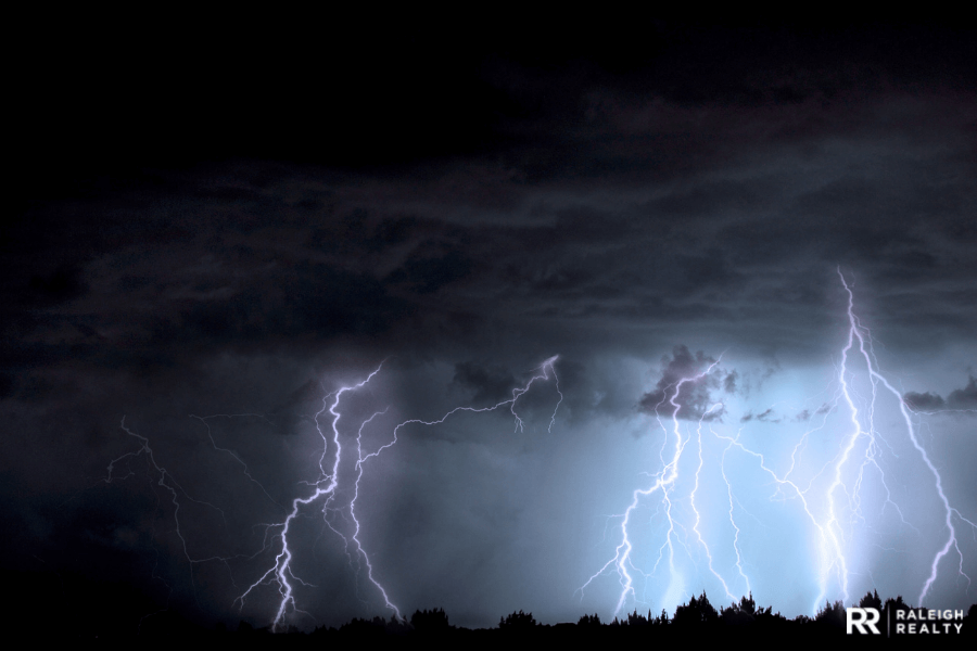
Lightning
Normally occurring in the clouds, lighting is an electrical discharge between storm clouds and the ground. This spark of electricity caused by imbalances can heat the surrounding air up to 50,000 degrees Fahrenheit which is five times hotter than the surface of the sun.
Safety Information
Contrary to popular belief, lightning can and will strike the same spot multiple times. Normally occurring during thunderstorms, lightning strikes kill up to 2,000 people every year.
-
Always seek shelter and stay indoors during a thunderstorm.
-
Avoid water.
-
Avoid electrical equipment.
-
Avoid windows, doors, porches, and concrete.
-
Do not stay in open vehicles or open structures.
When and What to Report
Only report lightning when damages and injuries occur.
Additional Lightning Resources
-
Lightning Safety Tips and Resources - National Weather Service
-
Lighting Basics - The NOAA National Severe Storms Laboratory
- Active Lightning Protection
Winter Weather
Winter weather may be issued as a watch, warning, or advisory and may consist of snow, sleet, freezing rain, wind chill, or blizzard conditions.
Safety Information
Winter storms are dangerous and can bring extremely cold temperatures, power outages, icy roads, and the loss of communication services.
-
Stay indoors.
-
Minimize travel.
-
Dress warmly.
-
Use fireplaces, stoves, space heaters, and blankets to stay warm during a power outage.
-
Conserve heat as much as possible.
-
Purchase a generator.
-
Keep water and food supply.
-
Bring all pets inside.
When and What to Report
Report any occurrence of freezing rain, ice accumulation, and damage as soon as possible.
-
How much heavy snow accumulation is there?
-
Is there any damage?
-
Do blizzard conditions exist: winds 35 miles per hour or more AND visibility is ¼ mile or less?
Additional Winter Weather Resources
Wind
The wind is the natural movement of air and other gases that can occur on various scales from strong gusts during a thunderstorm to calm breezes on a sunny day.
Safety Information
During severe weather, wind can be dangerous and is considered damaging when wind speeds surpass 50 miles per hour.
-
Postpone outdoor activities if a wind advisory is in place.
-
Take shelter.
-
Watch out for flying debris.
-
If driving, make sure to slow down or pull off of the road.
-
Secure all outdoor items that can be blown away.
-
Keep pets indoors.
When and What to Report
Report estimated or measured wind speed and wind damage while providing a detailed description of moving objects.
Details to submit for tree damage:
-
Was the tree healthy or decayed?
-
What type of tree was damaged?
-
Hardwood or softwood?
-
What is the height and diameter of the tree, branch, or limb that was broken or blown down?
Details to submit for damage to structures:
-
Is the damage to a well-built structure or a weak outbuilding?
-
What is the main building material of the structure?
-
If the structure is a mobile home, was it anchored down?
Additional Wind Resources
-
Tips for Estimating Wind Speeds for SWOP Observers - National Weather Service
-
Damaging Winds Basics - The NOAA National Severe Storms Laboratory
Hail
Hail is a type of solid precipitation that is formed in thunderstorm updrafts in extremely cold areas of the atmosphere.
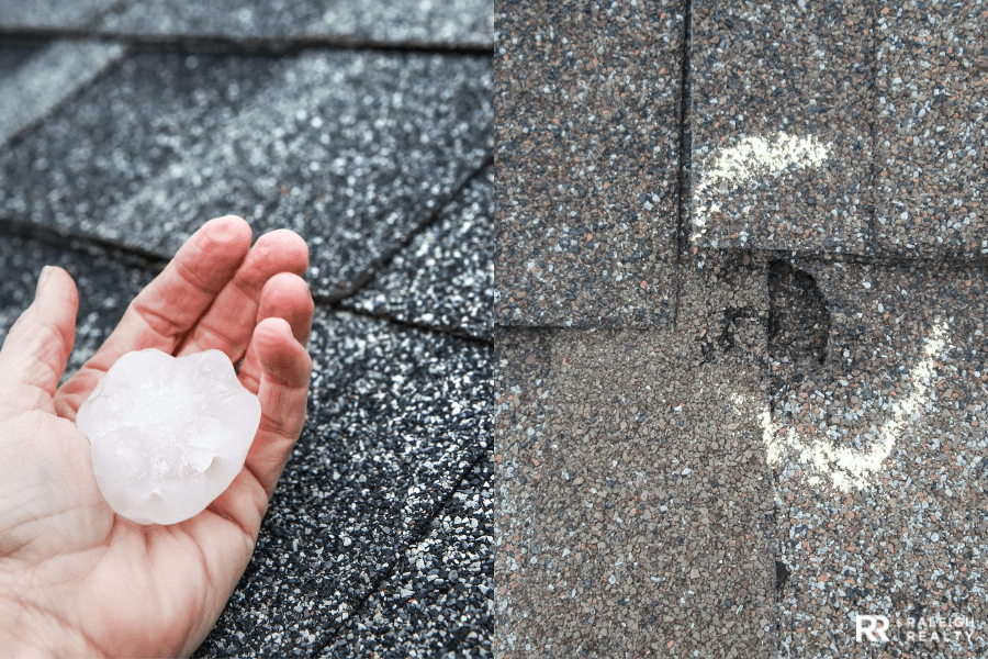
Safety Information
Hail is considered to be one of the most common and costly weather hazards. If hail is large enough, it can cause damage to homes, vehicles, aircraft, and can even cause death to people and animals.
-
Invest in a good home and car insurance.
-
Bring all pets inside.
-
Place vehicles inside of the garage or under a shelter.
-
Bring outdoor items such as furniture and potted plants inside.
-
Secure windows.
-
Be prepared for possible power outages.
-
Stay off of the roads.
When and What to Report
Hail can reach speeds of up to 90 miles per hour as it falls to the ground which in turn can cause a lot of damage.
-
Report the size of the largest hailstone and any damages.
-
Compare hail to well-known objects or measure with a ruler to report hail size.
Additional Hail Resources
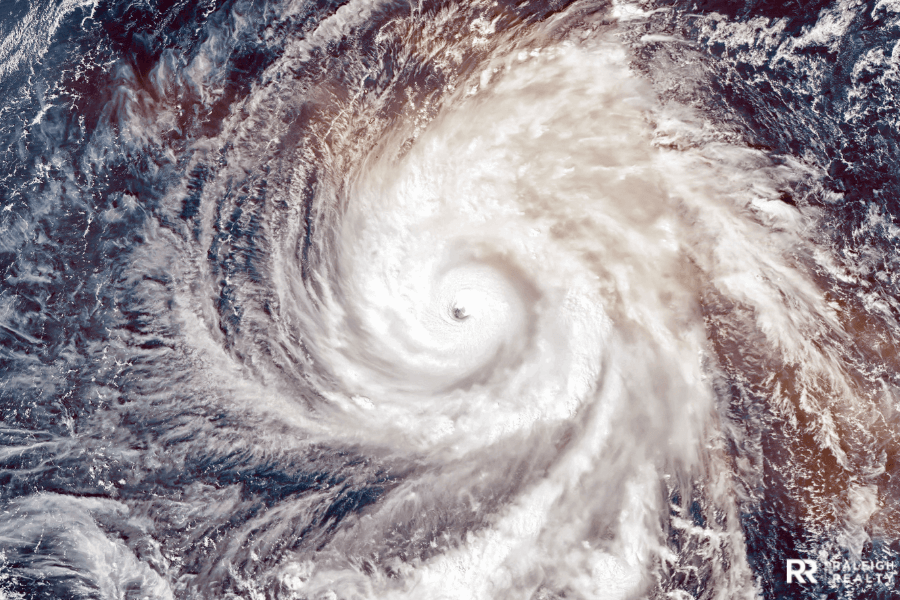
Marine Hazards
Coastal and marine hazards can include tsunamis, hurricanes, waterspouts, high surf, and flooding. Often causing high waves, extremely high wind, and heavy rain, marine hazards are a danger to those that live on the coast.
Safety Information
Weather near the coast can change quickly and can lead to dangerous conditions.
-
Be aware of weather warnings, watches, and advisories.
-
Have an escape plan in mind.
-
Be aware of all evacuation routes.
-
Do not go out on the water if there are dark and threatening clouds.
-
Stay away from flood-prone and low-lying areas.
-
Board up windows.
-
Have a pet plan.
-
Have a disaster supply kit.
When and What to Report
-
If there is a waterspout, is there rotation?
-
Are there squall lines and heavy freezing spray?
-
Do wave heights and winds differ significantly from forecasted conditions?
-
Are waves greater than twice the size of normal waves?
-
Are there hydrometeorological phenomena that are not in the current marine forecast?
-
Is there tsunami inundation and any damage?
-
Is there coastal flooding, lakeshore flooding, or high surf?
Additional Marine Hazard Resources
Additional Environmental Hazards
Other environmental hazards can include:
-
Dense fog: Visibility ¼ mile or less.
-
Dust Storms: Visibility ¼ mile or less.
-
Volcanic ash accumulation and any damage.
-
Any injuries or fatalities as a direct result of the weather.
How Do You Stay Safe As A Storm Spotter?
As a storm spotter, personal safety is the number one priority. Since storm spotting can be dangerous and life-threatening, all spotters can ensure their own safety and minimize the risk of injury and deadly situations by following the acronym ACES. Put in place by public safety officials, ACES is a guideline that all storm spotters should follow in order to stay safe.
ACES stands for:
-
Awareness: Always observe your surroundings and pay attention to changing weather conditions. Place yourself out of harm’s way by monitoring all possible risks.
-
Communication: Communicate with others around you and update them on your whereabouts.
-
Escape Routes: Always be aware of possible escape routes in case of a dangerous situation.
-
Safe Zones: Know the closest shelter and safe area available to you if you can not access an escape route.
Reporting Weather Events
The best way to report severe weather as a storm spotter is through the National Weather Service phone number, email, social media pages, or the Spotter Network. Make sure to follow specific reporting guidelines for your area. When reporting, remain calm, speak clearly, and do not exaggerate the facts. If you are unsure about what you are seeing, make your report, but also express your uncertainty.
Your report should contain the following:
-
WHO you are: the trained spotter.
-
WHAT you have witnessed: the particular weather event.
-
WHEN the event occurred: not when you make the report.
-
WHERE the event occurred: using well-known roads or landmarks.
Additional Storm Spotting Resources


Ryan Fitzgerald
Hi there! Nice to 'meet' you and thanks for visiting our Raleigh Real Estate Blog! My name is Ryan Fitzgerald, and I'm a REALTOR® in Raleigh-Durham, NC, the owner of Raleigh Realty. I work alongside some of the best Realtors in Raleigh. You can find more of my real estate content on Forbes, Wall Street Journal, U.S. News and more. Realtor Magazine named me a top 30 under 30 Realtor in the country (it was a long time ago haha). Any way, that's enough about me. I'd love to learn more about you if you'd like to connect with me on Facebook and Instagram or connect with our team at Raleigh Realty. Looking forward to connecting!